Clunypedia
A twelve-year practice digitizing and reconstructing Europe's lost heritage.
TECHNOLOGIES
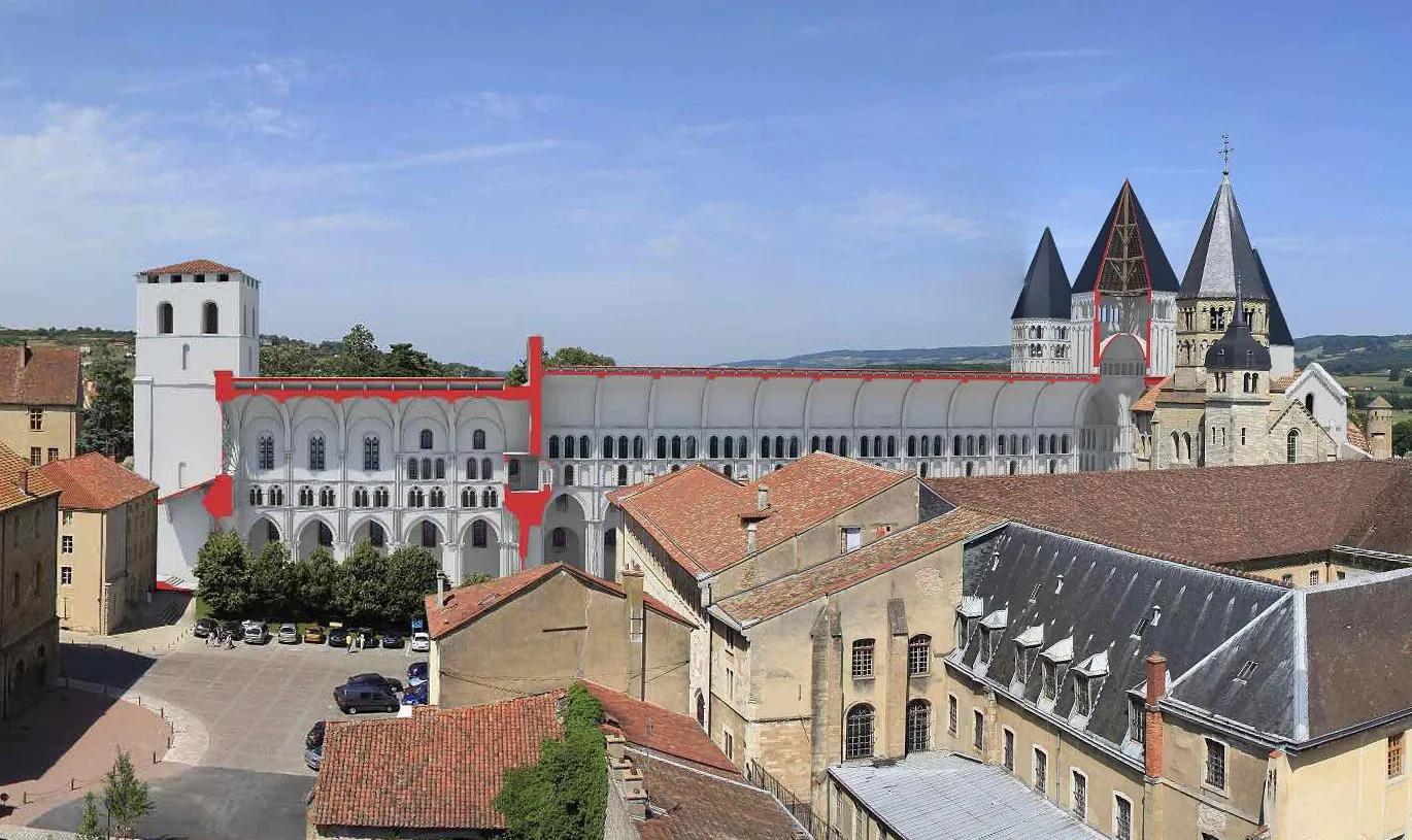
The largest church in the world, back on its footprint after two centuries.
For some six hundred years the church of Cluny Abbey was the largest one in Christendom — until St. Peter’s in Rome finally overtook it. Then the Revolution turned it into a stone quarry and it was demolished. I led the build of the AR (Augmented Reality) app that puts it back: stand in the field where the nave once rose, raise the device, and the lost church is there again — inside and out — for the first time in two hundred years.
Twelve years, across Europe.
The Cluny reconstruction was one piece of a body of heritage capture spanning more than a decade. From 2009 to 2020 I criss-crossed Europe photographing the Cluniac network — the priories and abbeys tied to Cluny between the 10th and 16th centuries — and gathered digital copies of numerous buildings and artefacts in 3D, mapped at clunypedia.com.
At Cluny itself the work fed Clunyvision, then ClunEtour, a guide to the medieval city: historical context, ancient engravings, 3D models of sculptures long gone from the site, and interactive panoramas of the vanished church. It ran at the tourist office for roughly ten years; some 100,000 visitors pass through each year. (The Cluny digitization was a team effort I contributed to; the AR app was a Paztec — the startup I co-founded — build I led.)
My first digital twin, before I had the word for it.
The instinct went back further. In 2007, for my final-year project, I digitized a ruined chapel — the Chapelle de Cruzille — and rebuilt its original state virtually from the capture data. When the real chapel was physically restored a few years later, I re-synced the model in 2012 to match what had actually changed: a digital counterpart tracking its physical original through time.
How it’s made.
Across these I worked in hybrid capture — terrestrial LIDAR (Faro Focus3D, Trimble scanners; a Faro articulated arm for sculpture) fused with full-frame photogrammetry in RealityCapture (now RealityScan), and Agisoft: LIDAR for high precision geometry, photography for colour and texture, each covering the other’s blind spots. At the rigorous end, I digitized the entire Abbey of Romainmôtier in Switzerland single-handed by manual photogrammetry — matching corresponding features across more than 3,000 photographs by hand — into a fully textured model, inside and out, that was used in a documentary film. At Cluny I field-tested the photogrammetry engine that would later become Acute3D, then Bentley ContextCapture — its inventors came to site to trial it with me, including aerial captures flown from helium balloons, before it was even a company.